
Days 64 and 65: Boat Harbour to William Bay via Parry’s Beach Campground
We acknowledge the Nyoongar People as the traditional custodians of the land and waters along the Bibbulmun Track

Today’s hike is extraordinary for wildflowers with drifts of colour sweeping across entire dune systems.
Overview Map of Boat Harbour to William Bay with overnight stay in Parry Beach Campsite
Use Use Bibbulmun Track Foundation Map 7: Walpole
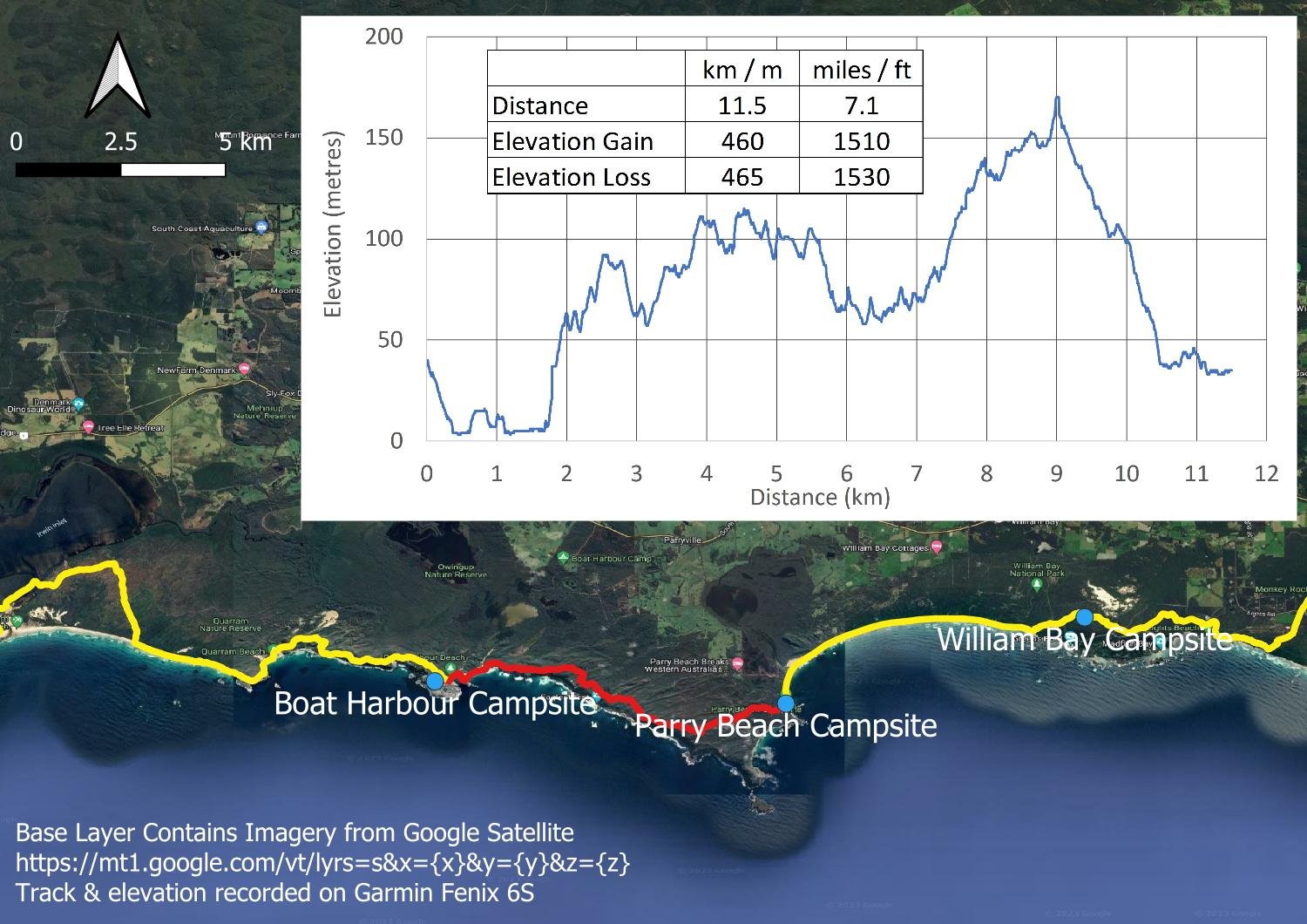
The track and elevation profile from Boat Harbour to Parry Beach
The conventional Bibbulmun route is 20.4 kilometres from Boat Harbour to William Bay, but we are slower hikers here and, believe me, there is plenty to enjoy with extraordinary wildflowers, views and variety to savour and photograph. In fact, one of the best tips given to us by another hiker was to split the standard day into two, stopping at the very pleasant Parry’s Beach campground neatly 11 km in. You will have had a big hike into Boat Harbor yesterday, and the next section from William Bay to Denmark has a long, rocky climb and descent on Mt Hallowell, so easier days between two big ones can transform an exhausting death slog into an enjoyable walk.

The track and elevation profile for the 10.9 kilometres from Parry Beach to William Bay

Sheltered little Boat Harbour Beach.

Views back over Boat Harbour Beach from the clifftops. The weather is perfect for hiking.

Views inland are wonderful as well, with freshwater lakes providing critical waterbird habitat. There is a surprising amount of standing water in the southwest of WA and, unlike much of the rest of Australia, a lot of the surrounding native vegetation remains pristine thanks to the native poison peas that killed livestock, precluding grazing. Presumably this area was also too wet for cropping.

Just look at that coastline!

A new Mignonette Orchid, Mictotis densiflora.

Stylidium adnatum

Oh. My. God. The pink is Pimelea rosea.

Can it get even more amazing? Yes, it can!

It’s like a garden! Pimelea, daisies and yellow Kangaroo Paw (Anigozanthus flavidus).

Banksia. It’s wonderful to see so many healthy specimens when phyptopthera is killing them throughout Western Auatralia.

I run out of superlatives. This 11 km section will be very slow for any photographer or botanist hiking in spring. You will use up the whole day, I guarantee it!

Blue Grass Lily, (Argrostocrinum scabrum)

And the Dunsborough Donkey Orchid, Diuris jonesii

At the volunteer-managed, council-owned Parry’s Beach Campground. The caretaker is very friendly towards Bibbulmun Track hikers, and the shop has excellent sugary snacks - please help keep this unique little place going by purchasing a few things!

Nice grassy campsites, close to the…
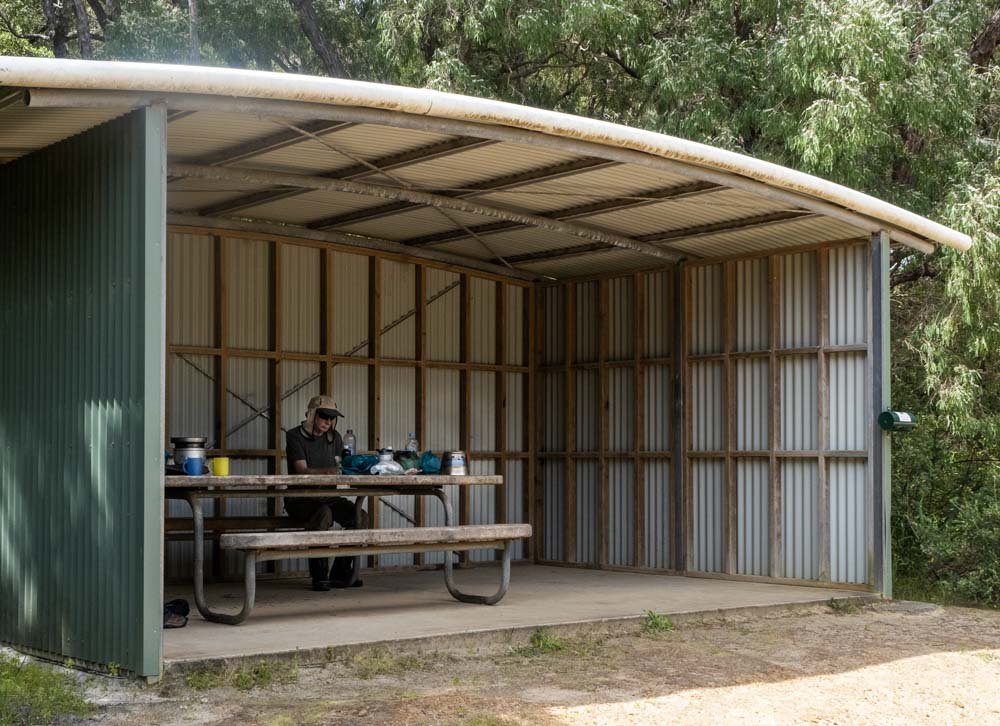
… basic but functional covered cooking area. There are hot showers!

And snakes!

Heading up Parry’s Beach the next morning. We’d shared the cooking area with Pat and Helen the previous night and both of us Helens were apprehensive about the inlet crossing today. We have left early to catch low tide because we have read and heard about this crossing being potentially extremely difficult. I’m so nervous that butterflies are cavorting in my stomach; I’ve slept poorly too. My mind is full of what ifs. Pat and Geoff are reassuring and seem inexplicably (and somewhat annoyingly) unconcerned.
A similar thing happened in Iceland when we were confronted by a wade through a fast-flowing stream. Of course Geoff and I managed just fine, linking up in correct form and using poles for extra support, but this inlet could be deeper. Or faster flowing. Or wider. What if we can’t cross? What if all our gear gets drenched? What if one of us is swept out to sea?

Here is Geoff crossing that terrifying inlet! We have timed it perfectly, of course, but my goodness, all that unnecessary worry and catastrophising! It is a good lesson and, although some of us will always worry more than others, it is a message that I take to heart. Since then, I’m proud to say that I’m much better at facing similar situations, reminding myself of The (not so) Terrifying Crossing whenever thoughts begin to spiral into ‘What If’ Doom. We discuss practical approaches further in our Staying Motivated on Long Distance Hikes, and this pyschologist hiker has excellent additional techniques to help those who suffer from anxiety or panic attacks while on the track.

Our friends Pat and Helen having lunch on Mazzoletti Beach with their trusty Trangia cook set; we have a laugh about the crossing. They walk at a similar pace to us, but we don’t hike as a group. Often we leapfrog each other, stopping at different times during the day. We spend different numbers of days in towns so some sections we are in synch, other times not. They are ‘Tramily’, or Trail Family.
To the right of them, the Bibbulmun Track climbs steeply up the foredune and ducks inland directly to William Bay hut but, at low tide, there is a longer alternate route around the headland, taking in Green’s Pool and Elephant Rock. The tide is coming in but we have time so decide on this route.

The detour is worthwhile, weaving between fabulous granite boulders
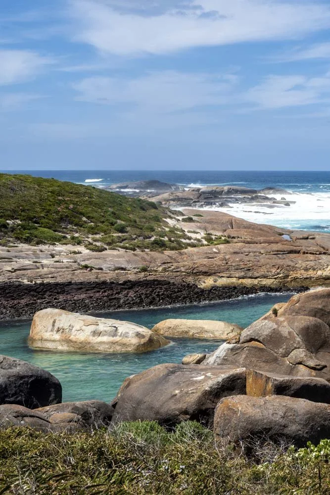
Geologists will love this section

Stylidium

Greens Pool is busy with holidaymakers and children splashing in the sheltered shallows. It’s one of those local secrets, with people returning annually for generations, as the Nyoongar no doubt did for millenia. Several locals stop to share their love of the place when we brew a cuppa.

Photographing flowers. Beautifully shiny black King Skinks (Egernia kingii) sun themselves on the warm rock but duck into crevices as soon as you approach. It’s at times like these I wish I carried a long lens, but I already have 2kg of camera gear!

Sticky Tailflower (Anthocercis viscosa)

A last steep trudge to the hut. I am hot, tired, and ready to stop. You can also see that I’m not carrying my camera - it’s clipped to Geoff’s shoulder strap - which is why an additional camera lens is unlikely to happen on long hikes!

William Bay Hut. The resident dugite slithered across the gravel to let us have the space.

Fantastic cosy campsites nestled amongst dense shrubs.
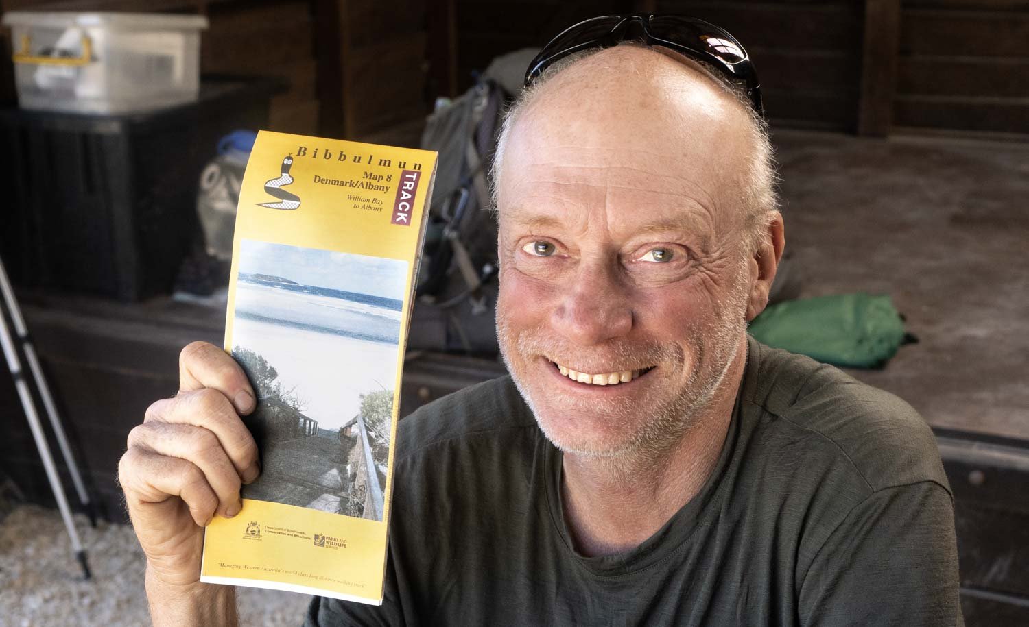
We’re on the last map!
