
Day 60: Frankland River to Giants
We acknowledge the Nyoongar People as the traditional custodians of the land and waters along the Bibbulmun Track

More of those amazing Tingle trees today!
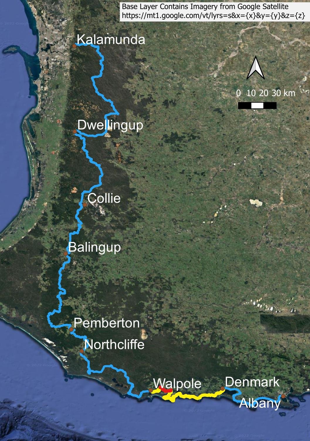
Overview Map.
Use Bibbulmun Track Foundation Map 7: Walpole

A long general trend upwards but with many ups and downs that make the day a challenging one
With 500m elevation gain over 15km with many ups and downs rather than long steady climbs, today’s hike is surprisingly demanding. However, you’re in beautiful forest the entire way, and there is the Treetop Walk in the afternoon to take you up into the canopy.

Although the nights remain cool, temperatures are warming earlier in the day. The pink cloth draped on my pack is a travel towel. We use a similar but much smaller microfibre cloth to dry the inside of our single wall DCF Triplex in the morning.

Western Australia has numerous boronia species, here B. gracilipes. Many have beautifully scented foliage as well as flowers.

You leave the Frankland River to continue heading east.

Lovely blue Karri Dampiera (D. hederacea)

Once again, the vegetation is quite dense. There will be more wildflowers near the coast tomorrow.

Typically quirky Australian road names. Placenames can be equally original, and much older. In Western Australia, you’ll notice that many towns have names ending in ‘-up’. ‘Up’ as a suffix is a Noongar language way of saying ‘place’, or ‘place of’. The first part of the name may be referring to trees, or rocks, water, sea, snakes or gathering… anything, really.

But then we reach the Valley of the Giants Treetop Walk. A coffee van is parked outside - yay! After cake and drinks, we pay for tickets at the visitor centre - you can leave your pack under the watchful eye of the ticket staff - and head up.
If you weren’t comfortable climbing rungs 60 metres vertically up the Gloucester (Karri) Tree in Pemberton, the Treetop Walk is a great alternative. You’ll gradually ascend to 40m above ground level, wire fencing either side and non-slip footing underneath. The tops of the Red Tingle trees (Eucalyptus jacksonii) are still another 30 metres above you.

Somewhat disconcertingly, climbers and engineers were taking measurements of the poles and wires supporting the walkway. A few weeks afterwards, the Walk was closed for repairs! Just as well we didn’t know this at the time! (It reopened not long afterwards).

After the Tree Top Walk, it’s only a short distance to the hut. I stood on a high fallen log to take this picture and, as I was clambering up, my shadow disturbed a large black tiger snake on the other side. It is the second snake we’ve seen today; the first was a dugite.

Many of the tent pitches are slightly domed, with a shallow gutter on the uphill side to prevent water sheeting under your tent floor. Last century, many of us were taught to ‘trench’ the tent by digging a shallow drain under the edge of the fly, but nowadays this violates LNT principles. Besides, the waterproof, relatively high bucket floors in modern tents are a far cry from floorless ones of old - if you have pitched your tent correctly, you should never need to trench it. We’ve had our Duplex in a running stream and stayed perfectly dry inside.
Tomorrow, we stop heading east and go south towards the coast, with new views and more open terrain. I can’t wait!