
Barigar to Gar
More spectacular views, waterfalls, montane wildflower gardens and tarns finishing with a gobsmacking campsite perched on a precipice
We respectfully acknowledge the Djab Wurrung and Jardwardjali people as the traditional custodians of the lands and waters of Gariwerd.

Stunning spring wildflowers

The elevation profile promises a long and steady climb but, don’t worry, the trail is beautifully constructed with breathtaking views almost the entire way to take your mind off tired legs. This might also be a favourite day for wildflower enthusiasts, with subalpine plateaus awash with colour. And you finish at gobsmackingly spectacular campsites with views to the distant horizon. A cracker of a day, and one of the most memorable of the entire trail.
How to Make Today Easier
As always, starting early will give you plenty of time to enjoy the views and wildflowers.
You also need not carry water for the entire day and/or evening/following morning from the start because there is a serviced rainwater tank about 4km (2.5 miles) in, where you cross Roses Gap Road. If you have left a food drop there, you will have lightened yesterday’s load.
Especially leisurely hikers can also split this day in two: Troopers Creek Campground is just 750m past the serviced water tank where you can do a food drop, so carrying an extra night’s food for that evening is not much of an impost.
Walk with Us:

Nearly all of the GPT is single track but here you’ll follow and zigzag across a dirt access track for a few hundred metres before crossing a pedestrian bridge over Brigg’s Creek. Today, the weather threatens rain: will it lift or clear?

This area appears to have been cleared and grazed in the past but now there are only roos. These are Eastern Grey Kangaroos, larger, less stocky and less flighty than the Swamp and Red-Necked wallabies you may see.
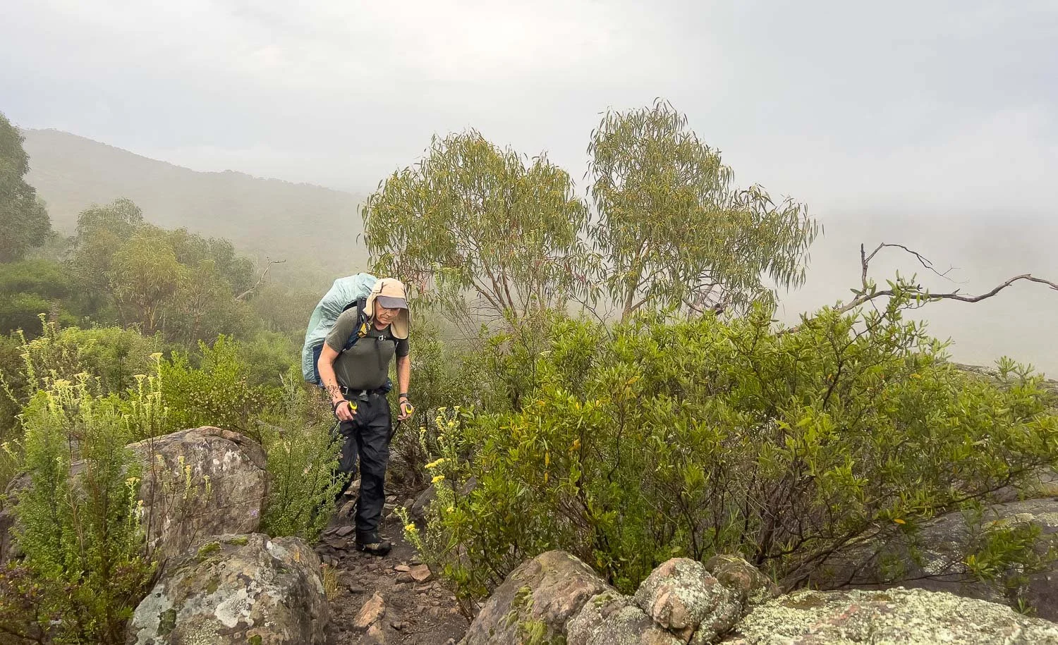
It’s jackets on-jackets off weather: not cold but drizzly; the sun is trying to reach through. We have chosen robust 3-layer goretex jackets teamed with lightweight Visp rainpants for this section. There is a big difference between hiking in mild wet weather and cold wet weather, especially with wind. Robust rain jackets are important for keeping your core warm, not just dry.

The tiny Notched Onion Orchid, Microtis biloba

And the Eastern Spider Orchid, Caladenia tentaculata. There were quite a few along here but it was raining when we passed so this is one I prepared earlier at Mt Zero.

Once again you’re following a narrow spine, so you have alternating and sometimes simultaneous views into the valleys on either side. The rising mist is delightful and the gradient gentle.

You still have rocky sections and little ups and downs.
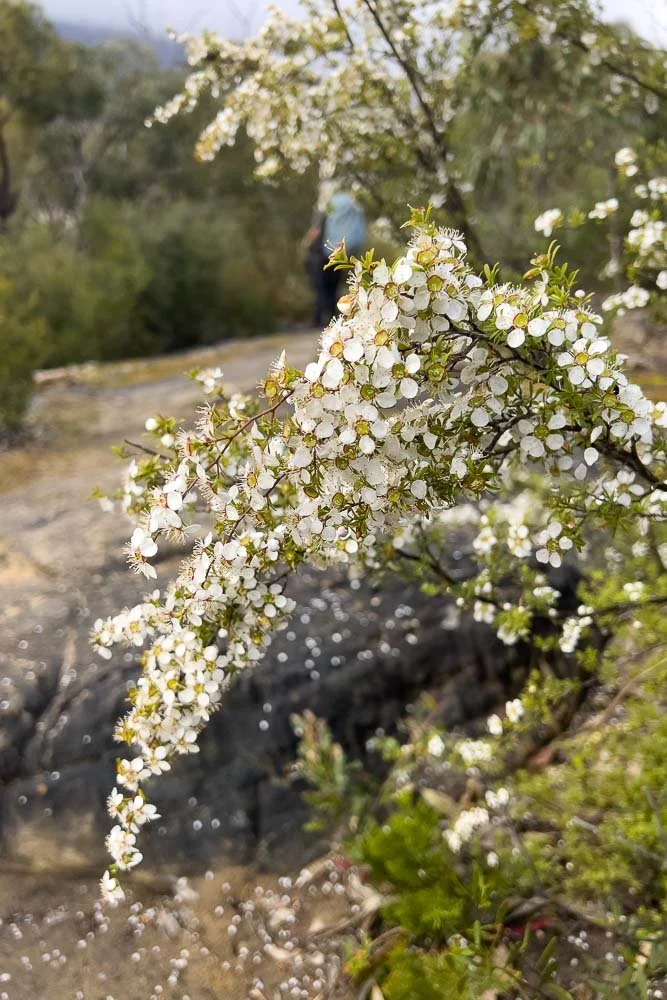
The track is festooned with wildflowers. You’ll see a lot of this tea tree, Leptospermum continentale…

…and red-fruiting hop bush, Dodonea viscosa ssp cuneata

It’s absolutely fantastic walking and pleasant underfoot.

As you descend towards Troopers Creek and Roses Gap Road, the vegetation changes. The track becomes sandy through Yellow Box forest, with swathes of Grampians thryptomene (T. calycina) below.
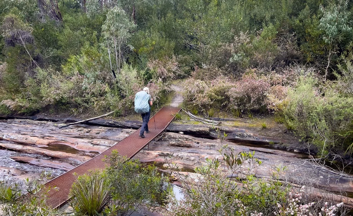
Crossing Troopers Creek.

And here just after crossing Roses Gap Road is the serviced tank, with a car park behind. If you’re doing a food drop here, we suggest hiding it somewhere discreet in the bushes nearby because day walkers frequent the area.

Different orchids are found in the shady, moist areas alongside creeks. Here, Trim Greenhood (Pterostylis concinna), recognisable by its forked labellum, grows below Melaleucas.

Caladenia ornata occurs on the southerly aspects as you climb out from Troopers Creek. You can distinguish this pink finger orchid from similar species because of its dark pink side lobes.

The trail passes several small but very pretty ephemeral waterfalls. If there has been rain overnight or recently, as happened with us, they will be flowing, especially in winter and early spring when the soil is still wet.

Crossing below the waterfall: this could get tricky after heavy rain.
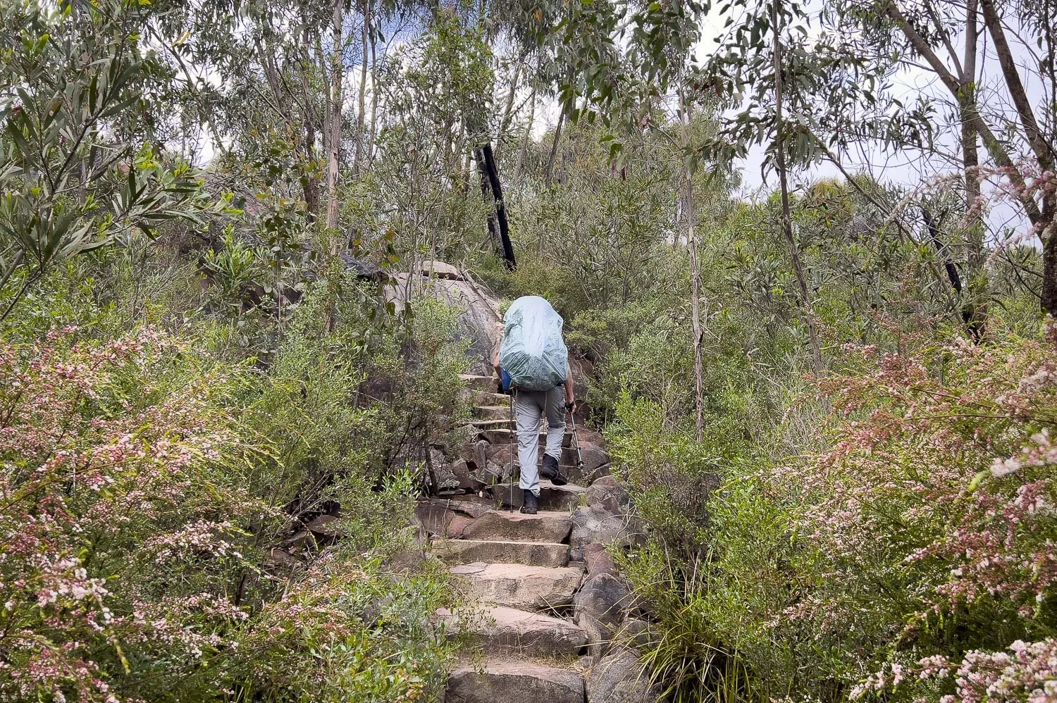
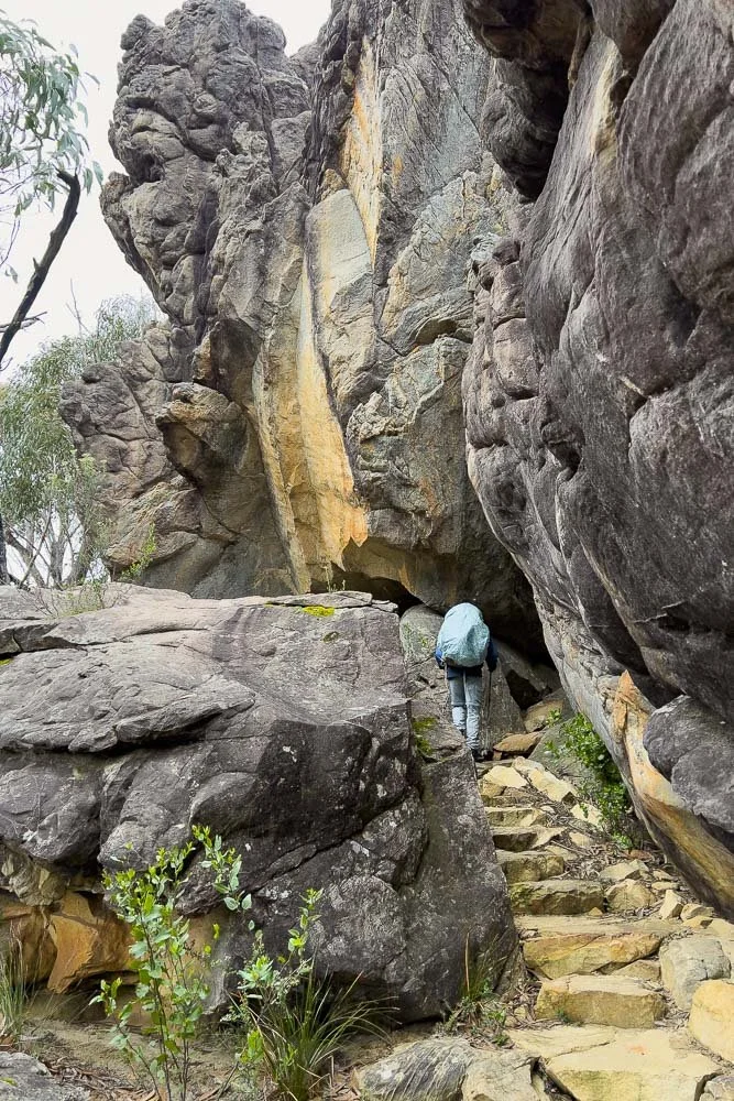
More steps. The day is now a series of climbs stepping up to the higher escarpments of the Mt Difficult range. You follow the base of cliffs before ascending them, cross a flatter area to the next escarpment, rinse and repeat.

Another marvellous waterfall. You’ll pass a 4km return spur trail to Beehive falls but these falls on the track are equally good; faster hikers may detour but slower ones will likely prefer not to. Instead we’ll ascend along the base of this cliff, climb up and then walk back along its edge.

Native violet (Viola hederacea) growing in the wettest areas

Views west all the way along the top of the escarpment.

Donkey orchid (Diuris orientis).

Approaching the next escarpment. You will climb this, and another couple more. They look daunting, but don’t be: the steep bits comprise steps that sidle and zigzag.

Hot homemade cup-a-soup and homemade crackers for lunch under an overhang. That’s the track directly in front of Geoff. It doesn’t look much from this angle but it’s relatively sheltered from the southerly wind and it’s great for another reason:

…The view! Perhaps you can begin to understand why this walk is so amazing: you’re nowhere near the highest escarpment yet still the views are there, not now and then but most of the time. Just wonderful.

Another shelf. You’re still heading northeast towards Briggs Bluff, top centre, the opposite direction from Gar campsite. But the escarpment below the campsite is too precipitous to approach directly, so you detour around and then head south in a big U-shape.

But first, below Briggs Bluff you cross this fantastic subalpine plateau, ablaze with wildflowers in spring. This little section will forever be one of our banner memories. The light was dull but the colours and rich diversity were astonishing. The path is easy here, too.

Grampians Bladderwort (Utricularia grampiana) thrives in wet open areas. They are carnivorous plants with tiny subsurface bladders that trap microfauna to digest. Another common name is Fairy Aprons!

Looking back along the little plateau you’ve just passed; you are in the process of stepping up to the next level. You can see the track snaking through it. And that’s Gar in the middle distance.

Grampians Boronia, B. latipinna

And here are the steps, lots of them, up the next escarpment. Is this the last one?

Looking back towards Gar. You are still heading away from it, but not for much longer!

Another plateau is at the top. You pass a beautiful tarn, and you are still heading away from Gar. Yes, there is another escarpment to ascend!

Showy Parrot Pea (Dillwynia sericea) and Violet Kunzea (K. parvifolia)

Tiny Fingers (Caladenia pusilla), ditinguished from other Pink fingers by well, their tininess!

The escarpment is not steep at this end. And oh my, the wildflowers will lift your steps; this section will fly by! Unless you are like me, when these sections are especially slow with so many plants to photograph!

At last you swing southwest towards Gar across yet another plateau awash with wildflowers. Isn’t it fabulous?
One last little climb through rock…

… and out the other side. You are nearly there and nearly all the climbing is also done!

Fantastic views south. The day has been spectacular.

Your absolute last push up sloping rock…

And you’re there!

The campsites are amazing. You will see why shortly.

But first, those with trekking pole/non-freestanding tents should bring line extensions and a few deck hooks to speed pitching.

You can see black guyline joining yellow line extension. Rocks are piled on the extension rather than the guyline so abrasion won’t damage the guy. The rocks are on the line because, with the Pro 2, lengthening the corner guylines a lot means the tent can lift: it’s held stronger laterally, but less strongly vertically. In strong winds, the trekking pole can pop out of alignment if the fly lifts when you haven’t deployed apex lines.

Any this is why the campsites are so wonderful: they are just a few metres from the edge of the escarpment you have been approaching all day; this is the view from our platform.

For some reason I took no photos of the outside of the hut but did take one of the glamping huts for those using the private tour company. These huts are smaller versions of your larger one, but with a few bunks inside.

Inside the communal hut showing the stainless steel bench for cooking and the charging station. There are hooks to hang packs but you are not meant to leave them overnight. When Geoff and I hang our ultrasil food bags in huts such as on the Bibbulmun Track, we take them out of packs and suspend them from cross beams with a 1.2m long thin spectra line and mini carabiner. Keeping your food in packs like this overnight invites critters to chew through them to get at whatever you’ve left inside.
If you have arrived in camp early and still have fuel in the tank, you have the option of hiking the spur trail to Mt Gar now rather than tomorrow. You will repeat just 300m of trail; the spur is an additional 1km to the peak so a total of an additional 2.6km today with an extra 100 m elevation gain. Doing this will knock 2 km off tomorrow’s 14.1 km distance. Although we’ve described the spur in Day 3’s blog rather than today’s, we elected to do the spur today and are glad we did, not least because the sky was clear and we thought rising mist or low cloud might obscure views in the morning.

Before bed, one last view from the escarpment on a stormy evening with squalls blowing through the valley. The day has been incredible. So many views, so many wildflowers, so many waterfalls. Just… wow.