
Duwul to Durd Durd
We respectfully acknowledge the Djab Wurrung and Jardwardjali people as the traditional custodians of the lands and waters of Gariwerd.
Climb the Grampians’ highest peaks and traverse remote montane wilderness

Stunning montane views today: you’ll be above 1,000m much of the time.
Today’s 14.5 km Grade 5 hike takes you up the two highest peaks in the Grampians: first, Mt William (Duwul) with 360 degree views to distant horizons. You’ll then drop briefly — steeply! — into Boundary Gap before climbing onto the wide Major Mitchell Plateau with its montane heath. You’ll pass Durd-Durd, the same height as Mt William but less prominent, before descending to the campsite. For much of the day you’ll be at or around 1,000m elevation.
Overview map
After yesterday, like me you may be wondering, “If that was Grade 4, what will today’s Grade 5 hike be like?”
Fear not. In poor weather, the Major Mitchell Plateau and Mt William are certainly exposed and dangerous, with whiteouts, snow and strong winds making them potentially impossible to traverse: this is the reason for the higher Grading. Be aware of this, and delay if the forecast is poor. However, in benign weather you will be pleasantly surprised. Geoff and I both found today easier than yesterday.

Duwul to Durd Durd Details Map
First, the climb to Mt William from the carpark is along a disused sealed road rather than uneven rock, and you will reach the peak in good time. The 200m descent into Boundary Gap is steep and rough, but the 150m climb out is up stone steps, and then you are on the plateau with its gentler gradients and steel walkways that protect the sensitive environment. Again, the walkways are easier to traverse, though you’ll still have plenty of rock too!
How to Make the Day Easier
Split the Day: First Wannon Campsite
We recommend this as the best option if you want to complete the entire section.
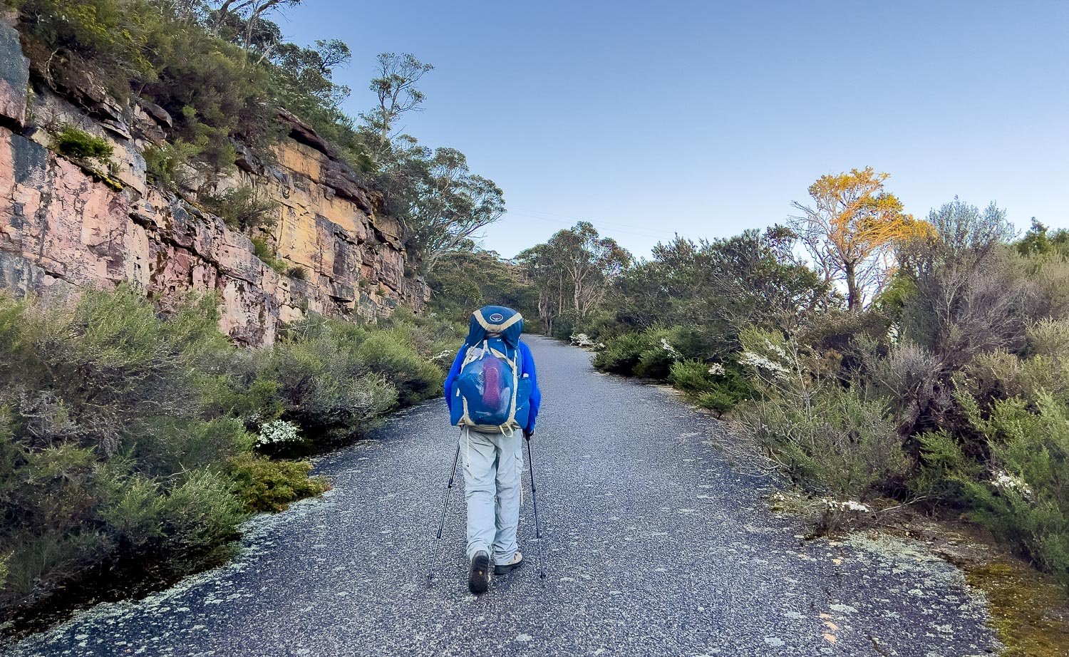
First Wannon Campsite is a bush camp with pit toilet. It is a pleasant spot and is perfectly situated midway between Duwul and Durd Durd. After the hard day to Duwul, we seriously considered stopping here (we always carry a spare day of food) but were feeling unexpectedly fresh when we reached First Wannon at lunch time so continued on. Stopping here allows you to split this long day in two, but most of the hard work is done by the time you get to First Wannon camp. You might like to keep it as a backup should you need it by ensuring you have enough food, medications and water with you. There is no public road access to this site and water from First Wannon Creek may not be reliable. The creek was running nicely when we hiked in early October, but you would need to check beforehand or ensure you carry sufficient water from the serviced water tank just past the Mt William summit.
Utilise Track Transfers to skip parts:
You can skip yesterday and Duwul altogether by getting picked up from Borough Huts, Redman Rd or Grampians Rd, and getting dropped off at Mt William Car Park. This is not least because the short section of track between Duwul and the car park is one of the roughest and slowest parts of the day:

When we set out from Duwul and almost immediately encountered this, I admit to having a little cry, thinking I and my buggered knee were in for another 14.5 km of rocks!
Or, get picked up from Mt William Car Park or the Mt William Rd water tank and get a transfer to Jimmy Creek Campground; from there, continue to Yarram Campground the next day. This means you’ll bypass not only Duwul Camp but also Mt William and Mt Durd-Durd. Do this only if you feel you can’t manage today because it is truly spectacular country that’s a shame to miss.
There are no other practical road transfer points between Duwul and Durd-Durd.
Manage your water, too. Rather than filling up for the day at Duwul, collect water from the tank just after Mt William so you’re carrying only an hour or two’s worth for the first climb of the day. And as always, starting early is a good idea for all us slower hikers on long days.
Take a look at the photos in today’s blog to decide whether this section is for you.
Walk with Us:

The rocky track from camp continues but there is Duwul with its radio towers up ahead. I envisaged that the climb to it would be more of same, and my heart sank.
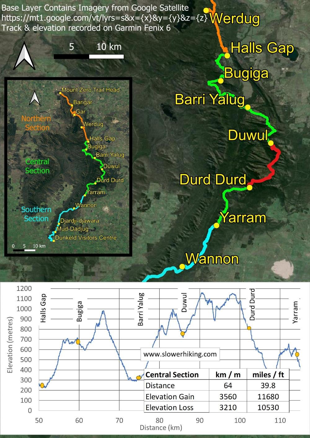
But no! Never have I been so happy for a bit of road walking! From the Mt William Car Park you follow this sealed but disused track all the way to the top, with colourful shrubs and orchids either side benefiting from the extra runoff and light.

Grampians grevillea (G. confertifolia)

In what seems like no time you are at the top. When we are there, on a forecast mild day, it is icy with a lazy easterly cutting straight through us. The summit itself with its radio towers, sheds and high fencing is butt ugly, so enjoy the views around you instead.

You’ll be able to see the track snaking off into the distance the moment you leave Mt William summit.

After undulating terrain, you begin the descent into Boundary Gap. It’s rough and rocky, so take your time whilst enjoying the views south.

The entire descent is like this but getting steeper.

Spike wattle (Acacia oxycedrus)
Yeah, right. I don’t think so! Geoff and I almost never complete hikes in the times suggested on signs. Instead, when planning our hikes, Geoff looks at elevation, distance and grading, and adjusts it to what he knows is our usual pace, which varies with terrain steepness and roughness (and temperature!). In this way, he knows whether we can complete a day comfortably by starting early, or whether we need to split it or preface it with a rest day. So it’s useful for all slower hikers to record these things for all their hikes to ensure challenging ones are achievable and enjoyable.

And now the climb out. Hooray, steps! Hundreds of them!

Don’t forget to look behind you now and then as you climb.

The track is well-built on the ascent rather than loose rock as on the descent. You’ll likely make better time than you expect. Directly above Geoff’s head, on the horizon, you can just make out the Mt William Towers.

Phew! It’s a steep climb, but there are wildflowers and orchids to cheer you on.
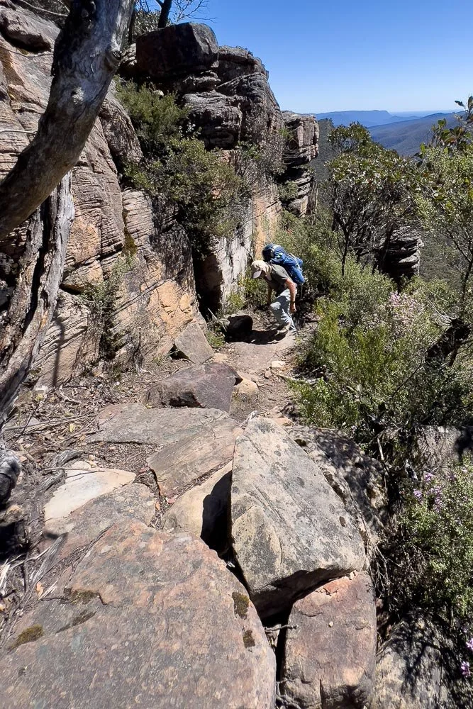
Up past cliffs…

…And finally onto Durd-Durd and sections of steel walkway. Here the terrain is still forested but, closer to the peak, views open up.

First Wannon Campground. It’s sheltered with both large and small sites, a good alternative place to overnight if you need to (remember to check that water is available in the creek or carry extra from the Mt William tank.)
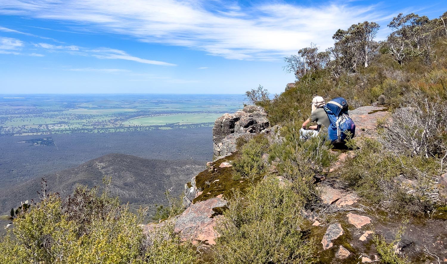
Wow. We never tire of this. Yet again as it does so much of the time, the GPT follows an escarpment, with views the whole way.

It’s still rocky, but the slabs have been laid, rather than tumbled by nature. Much easier walking!

Durd Durd. Although not an isolated peak like Mt William, this more rounded mountain has equally good views and a delightfully remote ambience, with only a rock cairn to mark the spot.

Grand views around Durd-Durd.

Wow. Views south towards the Serra Range (we’ll walk along the ridgeline during the Southern Section) and across the Victoria Valley to the Victoria Range.

More rocky descent, but it’s not relentless like yesterday.

And smooth sections of track, too!

A last scramble…

And into forest with much easier walking.

There’s even a little forest track, and prolific birdlife to sing you into camp!

Sheltered tent platforms at Durd-Durd...

And a few tent pads.

Charging station under the veranda of the loo.
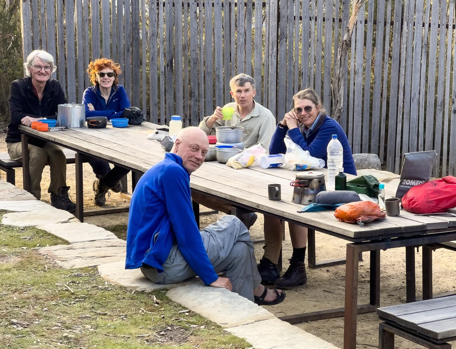
We have been walking this section with two other couples; we hike at different speeds but join up in camp. The people you meet on track are one of the best things about multiday hikes; you are certain to find kindred spirits. Geoff and I have never — never! — been on a hike where we’ve camped with others, and not learned something new. Coincidentally, we are all using different alcohol stoves with different sized pots. Alcohol stoves are slower, but can be a much lighter option than gas.

A last marvellous sunset view to cap off a day that has been filled with views. Tomorrow will be easier, with less elevation, less rocky track and, if you have a food drop at Jimmy Creek, clean socks, tshirts and perhaps a little treat!